Life in the big city
Posted: Fri Jun 02, 2017 8:26 pm
I like the nameless Great Basin region.
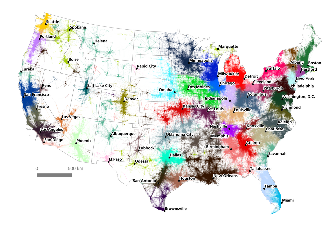
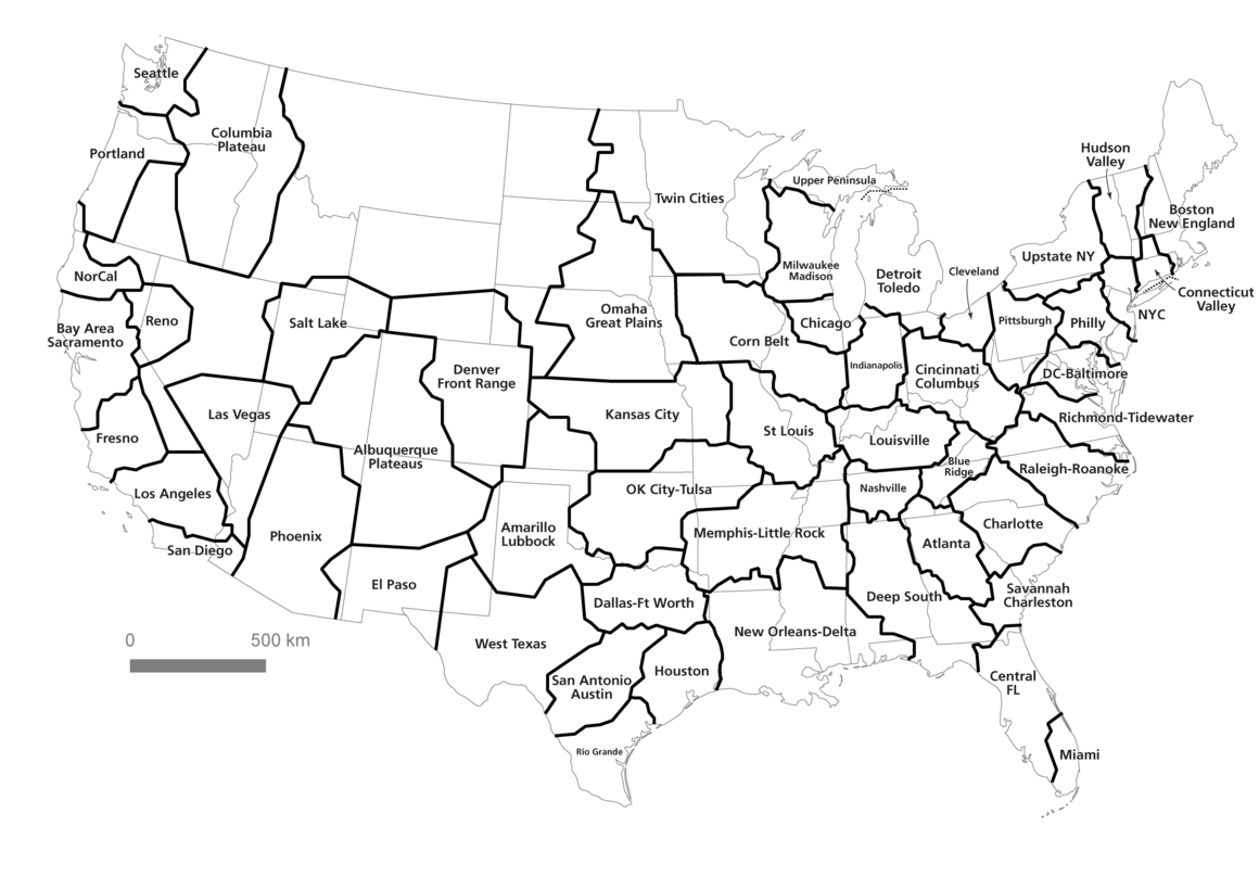
http://www.atlasobscura.com/articles/he ... -algorithmHere Are the Real Boundaries of American Metropolises, Decided by an Algorithm
How is the U.S. actually split geographically?
by Sarah Laskow November 30, 2016
When we think about where we live, usually our ideas start with political boundaries—we’d say we live in a particular state, city, or town. Ask about a neighborhood, sports team loyalties, or regions not defined by borders, though, and it might get a little fuzzier. In densely settled places like the East Coast, sprawl can make it hard to draw lines around places, too. Where in New Jersey does the New York City region end and the Philadelphia region begin?
These larger urban areas are sometimes called “megaregions,” and in a new paper, published in PLOS ONE, Garrett Dash Nelson, a historical geographer from Dartmouth, and Alasdair Rae, an urban analyst from the University of Sheffield, teamed up to identify them across the United States, using commuting data and a computational algorithm.
Essentially, they used data describing more than 4 million commutes to look at how small units of place—census tracts—are connected into much larger units of place. One of the results from their algorithm is the map above, which shows how the country is divided into economically entwined regions that don’t conform to city or state boundaries. Pittsburgh’s region spills into Ohio and West Virginia; Denver’s tips over the border into Wyoming; and Oklahoma City’s reaches into Missouri and Arkansas.