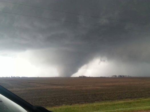
Lots of Tornado Activity In Indiana...
Posted: Sun Nov 17, 2013 9:02 pm
I hope @W isn't having to be out in this:
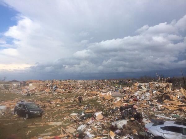
http://www.theindychannel.com/weather/i ... nds-sundayIndiana battered by tornadoes, damaging winds Sunday
Significant severe weather sweeps state
INDIANAPOLIS - 3:48 p.m.: Tornado warning for Boone, Clinton, Hamilton, Tipton until 4:15 p.m.
3:34 p.m.: Blackford, Grant, Huntington, Miami, Wabash counties until 4:15 p.m.
3:27 p.m.: Confirmed tornado 7 miles southwest of Kokomo. Tornado warning for Boone, Clinton, Hendricks, Fountain, Montgomery, Parke, Putnam counties until 4 p.m.
3:08 p.m.: Confirmed tornado reported between Vincennes and Decker, Ind.
2:30 p.m.: A confirmed tornado located near Covington, Ind., moving NE at 75mph.
*All times EST
A tornado watch is now in effect for most of Indiana until 8 p.m.
A very serious severe weather situation is setting up across Indiana on Sunday, with the possibility of multiple strong tornadoes and widespread damaging winds.
The first severe weather watch of the morning was issued about 9:30 a.m. It includes parts of northwestern Indiana in the Chicago area. Another tornado watch was issued before 11:30 a.m. for most of the rest of the state.
Supercell thunderstorms are forming in central and eastern Illinois. They will move into Indiana shortly thereafter.
The severe weather threat will persist from around noon toward the evening, when a cold front will move through, ending the threat from west to east.
"We've got two potential waves of severe weather. The first would be individual storms, potentially supercells with the greatest risk of producing damaging wind and tornadoes," StormTeam 6 Chief Meteorologist Kevin Gregory said. "Tornadoes and damaging wind are also possible along a squall line expected later in the day."
There is the potential for multiple strong tornadoes and wind damage that could affect a large part of the state.
Outside of the high risk zone, the entire state is in a moderate risk area for severe weather.
The National Weather Service issued a strongly worded outlook Sunday morning that said conditions "will be favorable for strong tornadoes with several long-track damaging tornadoes expected to occur from eastern Illinois … across much of western and central Indiana."