

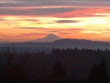
The California Drought
The California Drought
Your collective inability to acknowledge this obvious truth makes you all look like fools.
yrs,
rubato

The California Drought
I hope this rising tide floats all boats in California. Brace yourself for many mudslides.

“In a world whose absurdity appears to be so impenetrable, we simply must reach a greater degree of understanding among us, a greater sincerity.”
Re: The California Drought
[Brutal winter weather to impact 55 million as wind chill dips below 0]
Brutal winter weather to impact 55 million as wind chill dips below 0 1:32
Several feet of snow were forecast for parts of the West as a vast, record-setting band of winter weather swept across the region, freezing many cities, inundating others with floods and spurring authorities to warn of avalanches.
Winter storm warnings were in effect across much of the western third of the country early Thursday, from California to Colorado and Wyoming, including all of Utah's Salt Lake Valley.
Up to five feet of snow was predicted for the Sierra Mountain range, ahead of another winter storm this weekend that will bring several more feet of snow and raise the flood threat to central California.
One forecaster said parts of the range could see "enormous snow totals" of 10-15 feet or more thanks to a series of "atmospheric rivers" — narrow streams of concentrated moisture in the sky — that are expected to wash over the West into early next week.
Enormous snow totals still modeled: 10-15+feet from warm, very moist series of Atmospheric Rivers down-spouting over Sierra
Next 10-days: pic.twitter.com/U1cBfPWIJy
— Ryan Maue (@RyanMaue) January 4, 2017
"We are not done yet," warned NBC forecaster Bill Karins, predicting "epic" snow totals in the Sierra range. "The mountain ranges in Utah and Colorado will also see significant snow [during Thursday]," he said.
However, the huge amounts of rain and snow could put a significant dent in California's five-year drought.
Re: The California Drought
It's been so long we have forgotten what normal is like:

yrs,
rubato
yrs,
rubato

Re: The California Drought
Looks like a much warmer storm is heading California's way and will reduce the needed snow pack, as well as cause flooding.
RENO, Nev. (News 4 & Fox 11) — Flood watch in effect Saturday evening Jan. 7, through late Monday, Jan. 9. The flood watch is for the Greater Lake Tahoe area and Greater Reno-Carson City-Minden area, including the cities of South Lake Tahoe, Truckee, Stateline, Incline Village, Sparks, Gardnerville and Virginia City.
An atmospheric river will produce periods of intense rainfall with snow levels as high as 9,000’ early Sunday morning to Monday morning.
Rainfall totals of 6-12 inches are possible around the Tahoe Basin and Carson Range with 2-4 inches for valley locations.
California braces for weekend floods from powerful, warm storm
Northern California and the San Joaquin Valley are bracing for potential flooding this weekend, as a massive warm storm builds up off the coast. Forecasters say rainfall amounts could reach totals not seen in more than a decade. Already, some regions north of Sacramento are issuing voluntary evacuation orders.
A flood watch was issued Thursday by the National Weather Service from Saturday afternoon through most of Monday for 24 northern counties, including Sacramento.
If the storm follows its current trajectory, forecasters say it could send a particularly large gush of water to the southern Sierra Nevada mountains and into the drought-ravaged San Joaquin Valley. Fresno, Madera, Mariposa, Tulare and Tuolumne counties are under are flash-flood warnings.
The weather service on Thursday predicted that rainfall totals from Sunday and Monday could add up to more than 10 inches in some parts of the Sierra. The foothills near Grass Valley could see as much as 15 inches fall though Monday, the weather service reported.
In Sacramento, forecasters say up to 5 inches could fall by the time the storm passes.
* * *
Before the arrival of the weekend rain, skies will clear on Thursday and Friday. Highway 50 and Interstate 80 are open after Wednesday’s closures due to avalanche control, spin-outs and poor visibility.
So far, the rainfall total for the season stands at 10.98 inches, which is 147 percent of normal.
Read more here: http://www.sacbee.com/news/weather/arti ... rylink=cpy

Re: The California Drought
Here's what the Weatherbug forecast tells me we're looking at locally for the next week:
Tonight
A chance of rain in the evening...then rain after midnight. Lows in the 40s. East winds 5 to 15 mph.
Saturday
Breezy...rain. Highs in the upper 50s. South winds 20 to 30 mph with gusts to around 45 mph.
Saturday Night
Very windy. Rain. Rain may be heavy at times. Lows in the mid 50s. Southeast winds 20 to 30 mph increasing to 30 to 45 mph after midnight.
Sunday
Very windy. Rain. Rain may be heavy at times. Highs in the lower 60s. South winds 30 to 45 mph.
Sunday Night
Breezy...rain. Lows in the lower 50s.
Monday and Monday Night
Mostly cloudy. A chance of rain. Highs in the mid 50s. Lows in the lower 50s.
Tuesday
Breezy. Rain likely. Highs in the mid 50s.
Tuesday Night
Breezy...rain. Lows in the upper 40s.
Wednesday and Wednesday Night
Mostly cloudy. Breezy. A chance of rain. Highs in the mid 50s. Lows in the upper 40s.
Thursday
Cloudy. A chance of rain. Highs in the mid 50s.


Re: The California Drought
The worst situation for flooding, esp. in the Sacramento delta and environs, is a substantial snowpack followed by warm rains which releases both the current rainfall plus a lot of premature snowmelt. The levee systems are old and badly neglected and can fail catastrophically when a huge gout of water belches down the rivers and through the canals. And do fail. Usually this happens later in the season when a 'pineapple express' with a warm wet air mass arrives with more than usual rainfall.
I blame the fuckers at NOAA or the assholes at the NWS. What are they? astronomers? I want someone who is not just observing and commenting on problems I want solutions goddamnit!
yrs,
rubato
Re: The California Drought
http://www.latimes.com/local/lanow/la-m ... story.htmlCalifornia was bracing for an epic series of storms this weekend that could bring flooding, avalanches, blizzards and road closures.
Northern California is expected to be hit Saturday, Sunday, Tuesday and Wednesday.
Up to 12 inches of rain below 8,500 feet is expected, and massive amounts of snow — up to 6 feet — above that elevation. A fourth, colder storm two days behind will drop yet more heavy snow.
“It’s a once-in-10-year event,” said Zach Tolby, a meteorologist with the National Weather Service in Reno. “It’s the strongest storm we’ve seen in a long time, the kind of setup we look for to get significant flooding.”
http://www.inlandnewstoday.com/story.php?s=44735Several feet of snow were forecast for parts of the West as a vast, record-setting band of winter weather swept across the region, freezing many cities, inundating others with floods and spurring authorities to warn of avalanches.
Winter storm warnings were in effect across much of the western third of the country early Thursday, from California to Colorado and Wyoming, including all of Utah's Salt Lake Valley.
Up to five feet of snow was predicted for the Sierra Mountain range, ahead of another winter storm this weekend that will bring several more feet of snow and raise the flood threat to central California.
One forecaster said parts of the range could see "enormous snow totals" of 10-15 feet or more thanks to a series of "atmospheric rivers," narrow streams of concentrated moisture in the sky, that are expected to wash over the West into early next week.
"We are not done yet," warned NBC forecaster Bill Karins, predicting "epic" snow totals in the Sierra range. "The mountain ranges in Utah and Colorado will also see significant snow [during Thursday]," he said.
However, the huge amounts of rain and snow could put a significant dent in California's five-year drought.
http://www.cnbc.com/2017/01/06/californ ... state.htmlAs of Thursday, San Francisco was at about 130 percent of the historic average rainfall for this time of year and Sacramento was at about 160 percent. Also, there are some communities further north that have seen 170 percent more than normal precipitation for this time of year.
In fact, there's been so much rain that federal and state water projects this week have been conducting controlled releases of water from major reservoirs to make room for the upcoming storm flows. Releases have been done at Folsom Reservoir near Sacramento and at Shasta Reservoir north of Redding, California.
Shasta, the state's largest surface reservoir, this week held 118 percent of its historical average while a year ago it was just 50 percent of its average.
"We're not by any means out of drought conditions," said Thomas. "You could say we're doing better."
Indeed, the latest U.S. Drought Monitor released Thursday shows large swaths of the north, including portions of San Francisco Bay area, no longer suffering from drought. A year ago portions of the Bay region were still considered in severe drought. Overall, 38 percent of California is currently in what the monitor calls "extreme" or "exceptional drought" while that number a year ago was almost 70 percent.
It's a different story further south in Central and Southern California. Portions of Southern California, including Los Angeles and San Diego, have received above average rainfall this season but remain under some of the Drought Monitor's worst drought conditions.
As of Thursday, downtown LA was about 140 percent more than normal rainfall for this time of year. LA has already received more than double the amount of rainfall it received last year at this point.
"This is a great start but we've seen years where we got a fair amount of precipitation through the end of December then it was almost like nature turned off the spigot," said Devon Upadhyay, manager of the water resource management group at the Metropolitan Water District of Southern California. The agency is a large water wholesaler serving about 19 million people in six counties.
Re: The California Drought
Given the forecast, it looks you may want to growl another California draught.

Re: The California Drought
It's funny that you reference Russian River...
I was thinking earlier today that by the end of the weekend we'll probably be treated on the local news to scenes of the idiots that keep rebuilding their houses along the Russian River sitting on their roof tops again...
I was thinking earlier today that by the end of the weekend we'll probably be treated on the local news to scenes of the idiots that keep rebuilding their houses along the Russian River sitting on their roof tops again...
Re: The California Drought
Since about the middle of the night, it's been solid rain from southern Oregon to south of Los Angeles:
https://weather.weatherbug.com/maps/san ... .0258789,5
https://weather.weatherbug.com/maps/san ... .0258789,5
Re: The California Drought
A few days to dry out, and we're right back in it  :
:
I think this report has significantly underestimated how much rainfall the Bay Area is going to get from this first system...
As I mentioned it started a lot earlier than forecast, and is moving more slowly than predicted. And from looking at the Doppler, it doesn't look like it's going to be stopping any time soon. If anything it's getting stronger; right now the system extends all the way from Portland down to just north of LA:
https://weather.weatherbug.com/maps/san ... .0258789,5
http://www.mercurynews.com/2017/01/16/b ... n-the-way/
Bay Area forecast: Series of storms on the way
The Bay Area’s respite from the rain is expected to end Wednesday when the first in a series of storms delivers more wet stuff to the region.
The first system is expected to arrive Wednesday afternoon or evening [they got that wrong; it's been raining steadily since early this morning] and move south through the region, delivering heavy rain for three to six hours, [it's already been a lot longer than six hours, and it hasn't been a windy as they predicted, so its moving through more slowly] Walbrun said. Predicted rainfall amounts range from about a half-inch to 1.5 inches.
The second system is predicted to impact the Bay Area on Thursday night into Friday morning, Walbrun said. The system, which does not have as much moisture as the first storm, will be coming from the Pacific Northwest and has a “lot more cold air” associated with it.
The third system is expected to arrive Sunday morning and could have more substantial rain, Walbrun said.
Overall, the three storm systems could deliver three to five inches of rain to the coastal hills and two to four inches to cities throughout the Bay Area, Walbrun said.
Add those totals to the rain the Bay Area received earlier this month and “we’re looking at a wet January” with a “lot of rain across most of California.” Santa Rosa has already received 11.67 inches of rain this month.
The January storms have sent rainfall totals across the Bay Area surging above normal for this time of year. Since the rainfall season began on Oct. 1, San Francisco has recorded 14.63 inches (132 percent of normal), Oakland 13.10 inches (133 percent), San Jose 7.43 inches (113 percent) and Santa Rosa 30.09 inches (168 percent).
The storms are also expected to bring more snow to the Sierra Nevada, where the snowpack level is currently at a staggering 163 percent of normal.
Once the third system clears out next Monday or Tuesday, early indications are that the Bay Area will dry out for the rest of the month, Walbrun said.

I think this report has significantly underestimated how much rainfall the Bay Area is going to get from this first system...
As I mentioned it started a lot earlier than forecast, and is moving more slowly than predicted. And from looking at the Doppler, it doesn't look like it's going to be stopping any time soon. If anything it's getting stronger; right now the system extends all the way from Portland down to just north of LA:
https://weather.weatherbug.com/maps/san ... .0258789,5
Re: The California Drought
By the end of this week, the Sierra should have twice the historical normal snow pack. The dry spell appears to be over.

http://snowbrains.com/3-storms-are-abou ... gh-monday/The Eastern Sierras and much of northern California area about to get hit with 3 successive storms over the next few days. Round 1 is expected to arrive today, lasting through Thursday. Then, round 2 arrives on Friday and sticks around throughout the day into early Saturday. Finally, round 3 arrives on Sunday and lasts through Monday.
4 to 7 FEET of snow is possible in the Sierras through Monday.
NOAA has issued a Winter Storm Warning calling for 8-24″ of snow in Tahoe today and tomorrow.
California is going to experience a lot of precipitation throughout the state over the next 7 days.
The storm will be relatively light in the morning, then intensity will increase in the late afternoon, making the evening commute relatively wet and windy today.
Storm 1 Sierra Snowfall: 8 to 24″ Wednesday-Thursday
* SNOW ACCUMULATIONS...8 TO 15 INCHES OF SNOW POSSIBLE ABOVE 4500 FEET, WITH OVER
TWO FEET POSSIBLE ALONG THE HIGHER PEAKS.
Storm 2 Sierra Snowfall: Up to 24″ Friday-Saturday
This round of storms will arrive Friday and persist into the day Saturday, dropping large snowfall totals on much of the sierra. This storm will have relatively low snow levels, all the way down to 2000 ft.
Storm 3 Sierra Snowfall: Up to 30″ Sunday-Monday
This storm will move into the area Sunday and persist into Monday, leaving large amounts of snow throughout the Sierras. Along with relatively low snow levels that will drop down to 3,500 ft.
These three storms are expected to drop continuous snowfall on the sierras through Monday.
Above average precipitation and below average temperatures over the next 6-10 days should be the perfect combination for some blower powder in California.
-
Bicycle Bill

- Posts: 9862
- Joined: Thu Dec 03, 2015 1:10 pm
- Location: Living in a suburb of Berkeley on the Prairie along with my Yellow Rose of Texas
Re: The California Drought
What happens in the spring when that snowpack starts to melt? Not all that melt water is going to funnel neatly into the depleted lakes and reservoirs, especially after last season's fires depleted what little ground cover there was.
Mudslides and landslides and flooding, right?

-"BB"-
Mudslides and landslides and flooding, right?
-"BB"-
Yes, I suppose I could agree with you ... but then we'd both be wrong, wouldn't we?
Re: The California Drought
And earthquakes!Mudslides and landslides and flooding, right?
Your collective inability to acknowledge this obvious truth makes you all look like fools.
yrs,
rubato

Re: The California Drought
We are having an extended January thaw here. Rains have washed away any signs that it had ever snowed.
Life is good.
Life is good.
"When a man has so far corrupted and prostituted the chastity of his mind, as to subscribe his professional belief to things he does not believe, he has prepared himself for the commission of every other crime."
-- Thomas Paine
-- Thomas Paine
Re: The California Drought
The reservoirs exist to modulate the release of water from the melting snowpack into the state and federal water systems. We have a century of experience in doing this.Bicycle Bill wrote:What happens in the spring when that snowpack starts to melt? Not all that melt water is going to funnel neatly into the depleted lakes and reservoirs, especially after last season's fires depleted what little ground cover there was.
Mudslides and landslides and flooding, right?
The sierra snowpack is the largest volume of stored water in California and it it managed with that fact in mind.
Landslides are more due to local conditions, aging road infrastructure and mis-applied local building codes.
Flooding can be due to either local failures of structures like levees, which is a failure of government, or to inherently unforseeable events like rainfall of 10in+ in 12 hours which has happened.
yrs,
rubato

Re: The California Drought
Meanwhile, after getting pummeled two winters ago, We of the Northeast remain in drought conditions and We of the East of Massachusetts remain in severe drought.
And it was 47 in Boston today.
And it was 47 in Boston today.
“I ask no favor for my sex. All I ask of our brethren is that they take their feet off our necks.” ~ Ruth Bader Ginsburg, paraphrasing Sarah Moore Grimké

Re: The California Drought
Yes, our weather is alarming.  Last summer was like nothing I'd ever seen in my lifetime of Massachusetts summers/summer visits, and it's not looking great for next year. It's heartbreaking, really.
I'm not watching a lot of news right now because it has too much of a deleterious effect on my anxiety levels, all the Trump destruction already underway - but I did see that climate scientists confirmed 2016 as the hottest year ever since they began recording in 1882(?). Many of my favorite beaches on the Cape have already begun disappearing; I expect to watch them erode a great deal more in my remaining time on the rock.
I'm not watching a lot of news right now because it has too much of a deleterious effect on my anxiety levels, all the Trump destruction already underway - but I did see that climate scientists confirmed 2016 as the hottest year ever since they began recording in 1882(?). Many of my favorite beaches on the Cape have already begun disappearing; I expect to watch them erode a great deal more in my remaining time on the rock.
For me, it is far better to grasp the Universe as it really is than to persist in delusion, however satisfying and reassuring.
~ Carl Sagan
~ Carl Sagan